Smooth surfaces (snow) or rapidly changing areas (dense forests or water) provide few visual cues for reliable visual localization. Skyat is capable in finding matches in these scenarions. In addition, Skyat employs alternative means of positioning i.e., the inertial measurement units (IMUs), visual odometry and dead reckoning, come into play. Skyat improves its estimates from the last known location using these alternative means untill Skyat finds a match again.
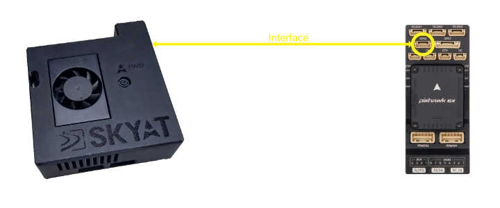
No, Skyat masks itself as a GNSS device. Platforms that support the MAVLink or NMEA protocols, e.g., PX4, ArduPilot, AuterionOS, MicroPilot, will accept Skyat data at the GNSS pin.
An example is provided below:
Skyat requires a clear line of sight to the ground for optimal performance. It is typically mounted on the belly of the UAV such that it has unobstructed nadir view.
Skyat consumes 15W during normal operation and up to 30W during peak usage.
Skyat provides integrations with third-party imagery providers. If you have privately available satellite imagery, please contact us for integration options.
We would love to hear from you. Reach out to our team at contact@skyat.io. We offer tailored demonstrations and are happy to discuss your specific mission requirements.